11.9.15

Snow Report 11 September 2015 - Australia & New Zealand


Hi everyone. We've just returned from beautiful Wanaka in the New Zealand South Island's Southern Lakes.

Conditions have been fantastic on the ski fields after a run of snow-bearing fronts over the past week or two has refreshed and spruced them up nicely ... and brought a few good powder days.

After the snow of 2 September, a sunny spell delivered some fun spring skiing on softening tracked snow at Coronet Peak:
Coronet Peak 03.09.15
Snow fell again during the night into the 4 September, with about 10cm reported at all the ski fields around Queenstown and Wanaka. The snow stopped and the clouds cleared just as lifts were opening ... making for a great day!

We headed for Coronet Peak again. The powder was smooth, silky and easy over at Rocky Gully, and pretty quiet for powder laps. Everywhere around the mountain was skiable, including some great terrain off Greengates lift and the usual good stuff at Exchange Drop.
Coronet Peak 04,09.15
Another follow-up front brought low-level snow on Saturday 5th September, including 15cm at Remarks, 10cm at Treble Cone and 5cm at Coronet Peak and Cardrona.

Winds caused some problems for the skifields, however and persisted into Sunday with some closures.

Monday was still windy and cold in the southwesterly, but the sun was out and the snow was in great condition. We headed up to Treble Cone:

Treble Cone 07.09.15
The Home Basin has lots of snow for this time of year, but the Saddle was where the action was. Dry winter snow made the whole basin skiable apart from a few groomed runs where the snow had scoured in the wind the day before.

The new coffee hut at Treble Cone was a bit exposed when we were there, so we didn't make use of it.

Two sunny days at Cardrona rounded off the trip. Conditions were brilliant with chalky winter snow on most of the mountain above the bottom of Whitestar.

Great cover across Captain's Basin:

Cardrona 08.09.15
The whole mountain was skiable over the two days, including the off-piste runs on Valley View alongside the creek, the Arcadia Chutes, and off-piste above Captain's.

Cardrona 08.09.15

The skifields around Queenstown and Wanaka are looking good for a good month or so yet, rounding off one of the best seasons I can remember.

2.9.15

Snow Report 2 September 2015 - Australia & New Zealand


Hello from Queenstown, New Zealand, where it has finally returned to winter conditions after a run of springy weather. The view from the balcony this morning, with fresh snow on The Remarkables:

The Remarkables 02.09.15
Snow has returned to the South Island after a run of sunny northerlies and northwesterlies were followed by a weird easterly storm. But despite its unusual weirdness, this storm has brought the goods with snow down to 800m across the South Island.

Snow looks to continue through the next few days and into the weekend, with the snow level dropping even lower to 400m.

Coronet Peak and Treble Cone have reported 15cm overnight, Ohau 30cm, The Remarkables 7cm, and Cardrona 10cm.

The weather system spun down from the North Island yesterday bringing easterly winds over the last few days. That's set to change over the next few days as we move back to a more traditionally westerly run.

This is the first snow for the South Island since 25th August. We were at Porters that day as the weather cleared, allowing good off-piste skiing from the top T-bar. Bluff Face opened that day, but there was not enough snow on Big Mama.

The following day saw some great conditions at Mount Hutt, with pistes groomed beautifully for a fast and sunny day on the new snow. Low cloud came in one day, but the mountain remained above them:
Mt Hutt 26.08.15
 You can see where a new blue run has been cut from the end of Virgin Mile, allowing return to the base on a groomed trail. Conditions were pretty thin at the bottom of International.

Since then, a run of sunny days has seen the lower slopes soften and off-piste begin to get solid.

We skied Mount Dobson on 27th August. There was still some nice snow around but also quite a few rocks. Stunning day though:


On 30th August we were at Ohau. It was very firm to start but softening by midday. There was quite good cover off-piste across the ski field:


Arriving in Queenstown, we checked out Coronet Peak on Monday. When the easterly clouds cleared a bit the solid snow turned softer and opened up some fun off-piste. It then became quite slushy in the warm temperatures.

The next week looks excellent with the new snow, and more to come ...

20.8.15

Snow Report 20 August 2015 - Australia & New Zealand


A run of northerly and northwesterly winds is bringing warmer conditions to Australia towards the end of this week, and they will arrive soon in New Zealand as well.

Falls Creek 19.08.15 [Source: Falls Creek FB page]

AUSTRALIA

It was mainly fine again over the weekend. A few snow showers fell on Monday and Tuesday then the weather cleared again.

The next few days look like rain, sadly, except for the highest peaks.

Mt Buller

Twenty lifts running now at Buller. Only Boggy Creek and Federation not running. Snow depth: 74cm

Mt Hotham

All lifts running at Hotham, including Blue Ribbon and Orchard. Snow depth: 106cm

Falls Creek

And all lifts running at Falls Creek. Snow depth: 106cm

Perisher 20.08.15 [Source: Perisher FB page]
Perisher

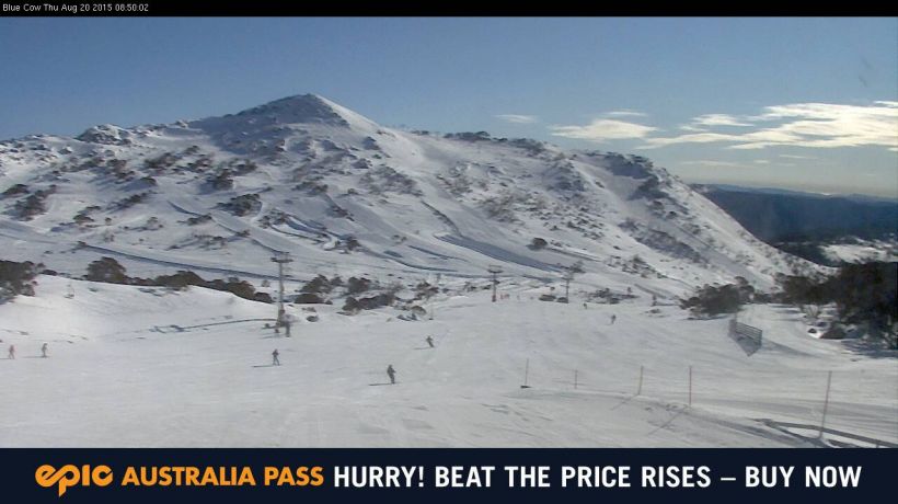
All 46 lifts are running at Perisher. where it has been a gloriously sunny day judging by the webcams.

Thredbo

All 14 lifts operating at Thredbo.


NEW ZEALAND

A windy start to the week with most resorts closed on Tuesday. Some snow arrived on Tuesday, favouring some resorts while others missed out.

It will be mainly fine and sunny through the weekend. Early next week looks the go for some more snow.

North Canterbury and Nelson

Rainbow received 20cm midweek - Snow depth 50/75cm
Hanmer Springs got rain so has closed again - Snow depth 15cm
Mt Lyford - Snow depth 55cm
Mount Dobson 17.08.15 [Source: Mt Dobson FB page]

Canterbury

Mt Hutt missed out on snow midweek - Snow depth 115/145cm
Porters - Snow depth 90/140cm

The Mackenzie

Ohau received 30cm into Wednesday - Snow depth 100/170cm
Roundhill - Snow depth 70cm
Mt Dobson - Snow depth 100cm

Wanaka

Treble Cone got 30cm (more in the Saddle) on Tuesday - Snow depth 108cm (top of the Home Basin)/200cm,
Cardrona received 10cm midweek - Snow depth 65/200cm

Queenstown

Coronet Peak received 5cm midweek - Snow depth 75/165cm
The Remarkables received 5cm as well - Snow depth 115/165cm

14.8.15

Snow Report 13 August 2015 - Australia & New Zealand


A mix of fine days and little top-ups of snow has kept conditions great and the skiing good fun in Australia, while New Zealand has returned to snowy conditions after a lean spell.

AUSTRALIA

Sunshine and nice conditions over the weekend. A few showers fell through the week including on Wednesday which brought a snowfall to freshen the slopes at some resorts.

A few snowfalls tending to cloud which will clear through the weekend as temperatures warm a little.

Perisher 13.08.15 [Source: Perisher webcams]
Mt Buller

8cm overnight. Twenty lifts running now at Buller. Only Boggy Creek and Federation not tunning today. Snow depth: 76cm

Mt Hotham

6cm and all lifts running at Hotham. Snow depth: 113cm

Falls Creek

Falls Creek received 5cm yesterday but International is still broken. Snow depth: 113cm

Perisher

All 46 lifts are running and 2cm dusting overnight for Perisher.

Mt Lyford 10.08.15 [Source: Mt Lyford FB page]
Thredbo

7cm into today and all lifts operating at Thredbo.


NEW ZEALAND

A big dump for Canterbury into the weekend, clearing early to fantastic conditions. Photos are from Canterbury this week to showcase how the conditions have improved there!

The skifields around Queenstown and Wanaka also received 5-10cm early on the weekend and the same again on Sunday night.

Porters 10.08.15 [Source: Porters FB page]
Fine weather returned across the South Island early this week, but snow has once again set in today and is expected to continue into the weekend.

There could be a big dump tomorrow for the skifields around Wanaka and Queenstown.

North Canterbury and Nelson

Rainbow - Snow depth 50/75cm
Hanmer Springs got enough snow to reopen - Snow depth 37cm
Mt Lyford - Snow depth 60cm

Canterbury

Mt Hutt received 43cm in 24 hours on the weekend. The South Face opened for the first time this season - Snow depth 107/137cm
Porters - Snow depth 90/140cm

The Mackenzie

Mt Hutt 10.08.15 [Source: Mt Hutt FB page]
Ohau - Snow depth 90/145cm
Roundhill - Snow depth 70cm
Mt Dobson - Snow depth 60cm

Wanaka

Treble Cone - Snow depth 104cm (top of the Home Basin)/200cm,
Cardrona - Snow depth 60/200cm

Queenstown

Coronet Peak - Snow depth 75/165cm
The Remarkables - Snow depth 120/170cm

6.8.15

Snow Report 6 August 2015 - Australia & New Zealand


Snow has returned on both sides of the Tasman, with midweek delivering the goods. Next week is also looking promising for a welcome return to winter weather.

AUSTRALIA

It was snow or rain on the weekend depending on whether you were in Victoria or New South Wales. The weather was a bit warmer than expected and Perisher got pretty wet. This week has been colder with some snowfalls at all resorts. There looks like being a little snow on and off until the weekend which should turn out to be mostly fine.

Falls Creek 04.08.15 [Source: Falls FB page]
Mt Buller

Some snow midweek including 5cm in the last 24 hours. A power outage since Tuesday has limited the number of lifts running. Hopefully that is sorted soon. Snow depth: 61cm

Mt Hotham

Over a metre on the ground now at Hotham with 7cm into Wednesday morning. Blue Ribbon was set to open today. Snow depth: 107cm

Falls Creek

Falls Creek received 10cm on Tuesday and 8cm on Wednesday. International Poma went down for cable repair and is still down, which is a pain for repeat accessing The Maze. Nevertheless, all terrain open at Falls and great skiing to be had. Snow depth: 86cm

Perisher

The wet weekend is a distant memory with snow today and 46 lifts are running.

Thredbo
Mount Dobson 04.08.15 [Source: Dobson FB page]

5cm into Wednesday and the same again into Thursday.


NEW ZEALAND

Almost a foot of snow fell midweek after some warm and windy conditions earlier. Looks like a significant snowfall over the next few days, especially in the south of the South Island.

North Canterbury and Nelson

Rainbow - Snow depth 30/48cm
Hanmer Springs is still closed awaiting new snow - Snow depth 25cm
Mt Lyford - Snow depth 38cm

Canterbury

Mt Hutt received 12cm on Wednesday - Snow depth 75/105cm
Porters - Snow depth 80/120cm

Treble Cone 05.08.15 [Source: Treble Cone FP page]
The Mackenzie

Ohau received a much-needed 30cm midweek dump - Snow depth 75/115cm
Roundhill - Snow depth 50cm
Mt Dobson got 30cm midweek - Snow depth 60cm

Wanaka

Treble Cone is looking excellent in both basins - Snow depth 99cm (top of the Home Basin)
Cardrona - Snow depth 60cm

Queenstown

Coronet Peak - Snow depth 75/160cm
The Remarkables - Snow depth 100/150cm

30.7.15

Snow Report 30 July 2015 - Australia & New Zealand


We have just a few days to go and then we're into August. The good news is that all the ski resorts and skifields across Australia and New Zealand are open, and conditions are rocking - they're pretty good!

AUSTRALIA

A snowy weekend and some little top-ups of snow during this week have seen some of the best conditions on the slopes of the season so far. A bit of snow is forecast for tonight and more on the weekend.
Mt Buller 30.07.15 [Source: Mt Buller webcam]

Mt Buller

33cm from the recent storm. Mt Buller now has 15 lifts running, with Bull Run opening on Tuesday for skiing down Standard. Grimus, Southside, Federation and Boggy Creek lifts are yet to open. Snow depth: 56cm

Mt Hotham

37cm from the weekend snowfalls. Sunday saw the opening of the upper Blue Ribbon runs along with Lower Playground, Pipeline, Off The Edge and the Wall of Death. Monday saw Gotcha open and Wednesday saw Keogh's and The Orchard open. Snow depth: 83cm

Falls Creek

Falls recorded 42cm in snowfalls. Lakeside Poma opened Monday along with bits of The Maze. International opened later in the week meaning all lifts at Falls are now running. Snow depth: 86cm

Falls Creek 29.07.15 [Source: Falls Creek FB page]
Perisher

Perisher reported a whopping 70cm from the snowy storm cycle. The four resort areas are all open and 45 lifts are running.

Thredbo

All ski lifts are now running at Thredbo after 46cm fell in the recent storm.


NEW ZEALAND

Rain, wind, sun and some snow over the weekend with the northwesterly airflow. A bit of everything! Then a decent snowfall arrived in the middle of the week. A few top-ups are likely again this weekend, although the freezing level is quite high. Next week is looking promising for a return to more wintery conditions.

North Canterbury and Nelson

Rainbow - Snow depth 30/48cm
Hanmer Springs is still closed awaiting new snow - Snow depth 40cm
Mt Lyford received 15cm on Wednesday - Snow depth 50cm

Canterbury

Mt Hutt received 12cm on Wednesday - Snow depth 75/105cm
Porters - Snow depth 100/120cm

Mt Hutt 30.07.15 [Source: Mt Hutt FB page]
The Mackenzie

Ohau - Snow depth 60/100cm
Roundhill - Snow depth 50cm
Mt Dobson got 7cm midweek - Snow depth 60cm

Wanaka

Treble Cone - Snow depth 91cm (top of the Home Basin)
Cardrona - Snow depth 70cm

Queenstown

Coronet Peak - Snow depth 75/175cm
The Remarkables - Snow depth 100/150cm

23.7.15

Snow Report 23 July 2015 - Australia & New Zealand


We are now into the peak of the ski season in both Australia and New Zealand. With no school holidays on and more lifts open its a great time to go skiing.

AUSTRALIA

It was fine and sunny through the weekend until Tuesday. Then, a little rain arrived on Wednesday as well as some strong winds. The forecast has some very good snowfalls arriving from Friday night and continuing through into Monday. Early next week we could have closer to 1 metre of snow on the ground.

Falls Creek 23.07.15 [Source: Falls Creek FB page]
Mt Buller

Mt Buller now has eight lifts running but there is still plenty of terrain yet to open. It needs a good snowfall to get things really going. Snow depth: 31cm

Mt Hotham

Rain and a little snow over the past few days has softened the snowpack. It will take another 40cm or so to open The Orchard. Snow depth: 52cm

Falls Creek

Falls received 4cm overnight and has great cover for intermediate skiing across Sun Valley. More snow needed for the advanced areas to open fully. Snow depth: 46cm

Perisher

12cm snow overnight with 40 lifts operating means Perisher certainly has the most extensive terrain open in Australia.

Thredbo

5cm overnight with the resort recommending the groomed runs for the best skiing.


Porters 23.07.15 [Source: Porters webcam]
NEW ZEALAND

Cold and snowy on the weekend with up to 15cm at some skifields. It has become fine during the week with some nice sunny days.

It looks like being mainly fine but perhaps a little unsettled this weekend, with unusually warm temperatures. Some snow would be welcome next week.

North Canterbury and Nelson

Conditions are marginal in the north.
Rainbow is warm today with good conditions on the groomed runs - Snow depth 38/60cm
Hanmer Springs has been closed this week - Snow depth 40cm
Mt Lyford received 30cm on Saturday to get things going - Snow depth 50cm

Canterbury

Mt Hutt received 17cm on Saturday - Snow depth 80/130cm
Porters has its signature Big Mama run open and good cover up high - Snow depth 100/120cm

Treble Cone 23.07.15 [Source TC webcam]
The Mackenzie

Cover is ok but not amazing in the Mackenzie.
Ohau looks like it could do with a good dump  - Snow depth 53/95cm
Roundhill - Snow depth 50cm
Mt Dobson - Snow depth 60cm

Wanaka

Treble Cone is looking great in terms of coverage - Snow depth 83cm (top of the Home Basin)
Cardrona has warm sunny conditions today - Snow depth 80cm

Queenstown

Coronet Peak - Snow depth 75/175cm
The Remarkables - Snow depth 100/150cm